Drone Operation: Radio Communication for Nearby Aircraft
If you fly drones long enough, you’ll inevitably find yourself in situations that go beyond the routine—where your standard checklist isn’t quite enough, and quick thinking becomes just as important as pre-planning. That’s exactly what happened during a recent mapping project in Lancaster, Pennsylvania. Operating near active, non-towered airspace added a layer of complexity that required a refreshed focus on Part 107 protocol and a few extra tools in the field kit. This write-up highlights key strategies, radio communication tips, and situational awareness tactics that every licensed UAV pilot should keep in mind when flying near manned aircraft.
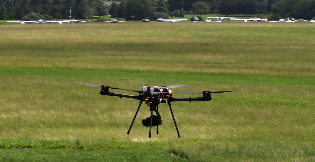
This project was flown by the Carlson CRD1 in Bird-In-Hand, Pennsylvania, within Class E4 airspace—an extension of Lancaster Airport’s controlled airspace for instrument approaches. While operations in this airspace are legally permitted under Part 107, the proximity of Smoketown Airport, located approximately 1,200 meters directly west of our site, presented a notable safety consideration.
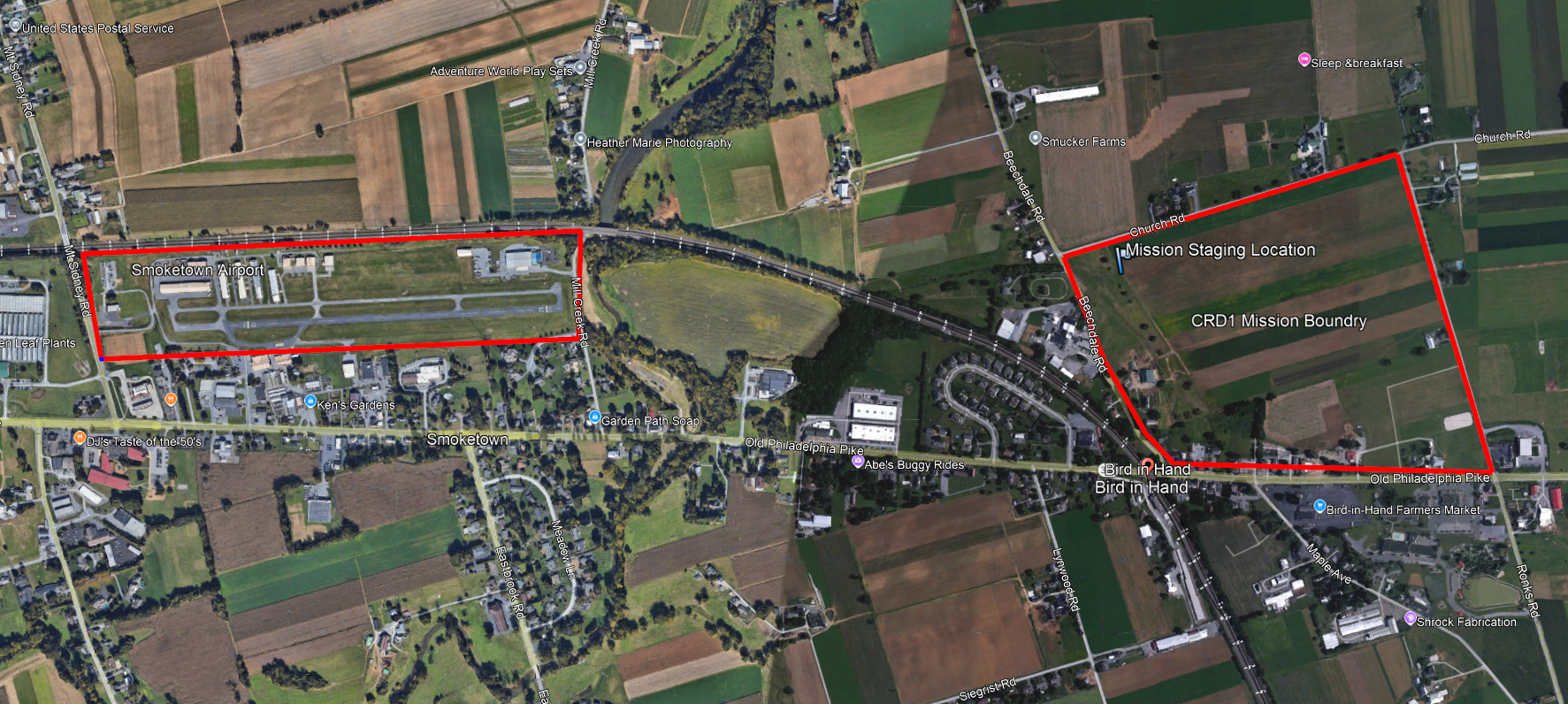

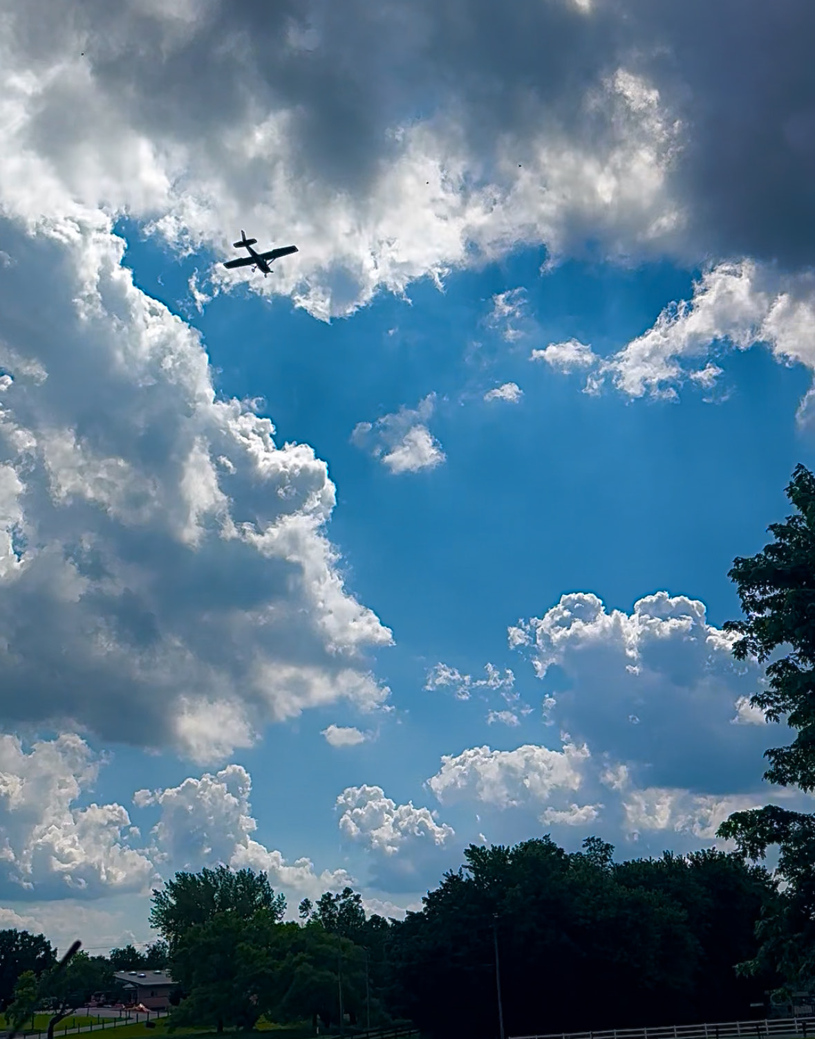
Smoketown is a non-towered general aviation airport, meaning it lacks an air traffic control tower. Pilots operating in and out of the airport self-announce their positions and intentions on a designated UNICOM frequency. This creates a challenging dynamic for UAS operators, as we are sharing the same low-level airspace with manned aircraft without centralized coordination.
To ensure the safety of both our drone operation and surrounding air traffic, we made several adjustments to our standard flight procedures. The project area covered approximately 100 acres. Under normal conditions, we would conduct LiDAR scans at 200 to 300 feet AGL and photogrammetry flights at 400 feet AGL to maximize our coverage. However, due to the frequency of manned aircraft traffic during our mapping—approximately a dozen fixed-wing and rotorcraft approaches over our site—we chose to operate at a reduced altitude of 200 feet AGL.
Visual Observers: Team members were assigned solely to observe the airspace and alert the RPIC of any inbound traffic. Although ADSB is mandatory for all aircraft with electrical systems, there is a change they may not be broadcasting.
To further enhance situational awareness and airspace safety, we employed the following safety measures:
ADSB Tracking: We actively monitored nearby aircraft using ADSB Exchange, a real-time aircraft tracking platform. It’s important to have a mobile hot spot or phone to view live data.
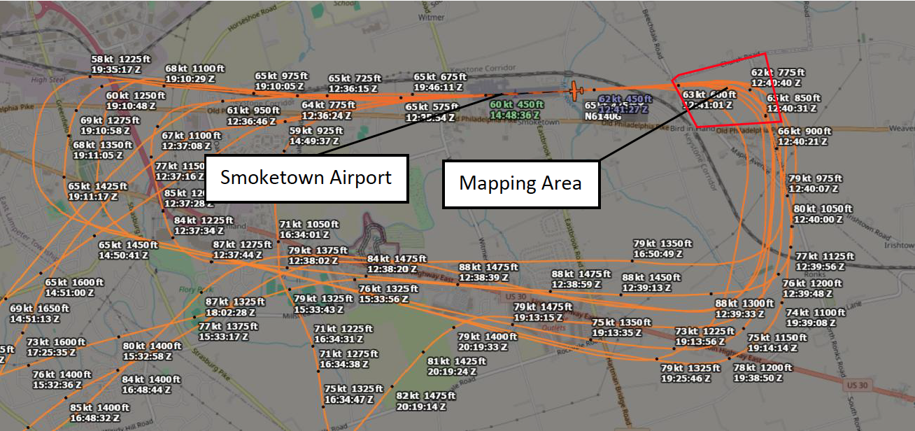


*Here is the the ADSB data of one of several aircraft that made low level approaches during the course of our CRD1 mission.
*Aircrafts glide slopes for Smoketown airport are below 400ft, our legal maximum altitude in this area.
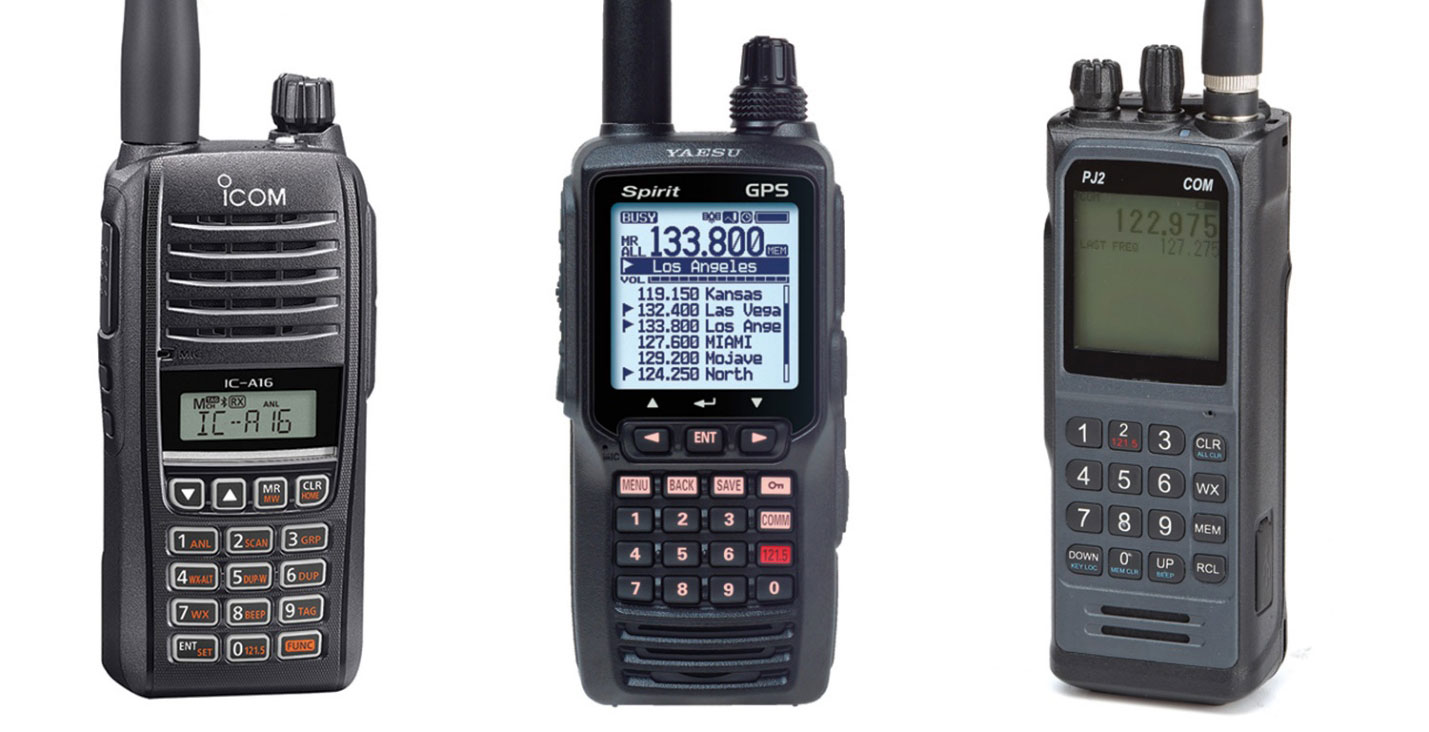
Handheld Aviation Radio: We utilized an aviation-band handheld radio to monitor Smoketown’s UNICOM frequency and, if necessary, communicate directly with nearby aircraft. There are a number of handheld radios to choose from. They range from $200 to $500.

Radio Communication Protocol for Drone Operations Near Non-Towered Airports
When operating near non-towered airports, direct communication with manned aircraft may be necessary to avoid conflicts. Many non-towered general aviation airports and heliports may not have drone flight restrictions or FAA LAANC (Low Altitude Authorization and Notification Capability) authorization.
Use the following protocol when using a handheld aviation-band radio:
Radio Call Protocol
-Tune to the Airport’s UNICOM Frequency
Example for Smoketown (ask FAA charts or foreflight):
-Initiate the Call
-Use standard aviation phraseology
-Identify the airport first, then yourself, then your position altitude and intentions
Example Call:
“Smoketown traffic, drone operation located 1,200 meters east of the field at 200 feet AGL, conducting mapping over a 100-acre area. Monitoring frequency will yield to traffic. Smoketown traffic.”
-Maintain Listening Watch
-Continue to monitor traffic calls from approaching aircraft
-Be prepared to update your position as the situation evolves
Optional Call for Deconfliction (if aircraft is approaching your airspace):
“Aircraft approaching from the west to Smoketown, drone team operating at 200 feet AGL, 1,200 meters east of the field. Please advise your position or intentions.”
-Cease Operations if Necessary
-Land or descend immediately if there is a risk of airspace conflict
When operating near a non-towered airport, it’s important to use the radio responsibly and efficiently. Keep all transmissions brief to avoid occupying the frequency and potentially interfering with aircraft communications. Familiarize yourself with the airport’s traffic pattern—including runway orientation and the standard pattern legs (crosswind, downwind, base, and final)—so you can anticipate when and where aircraft may appear, as well as the typical sequence of pilot radio calls. This awareness allows you to listen more effectively, avoid stepping on other transmissions, and time any necessary drone-related callouts without disrupting manned aircraft communication.